|
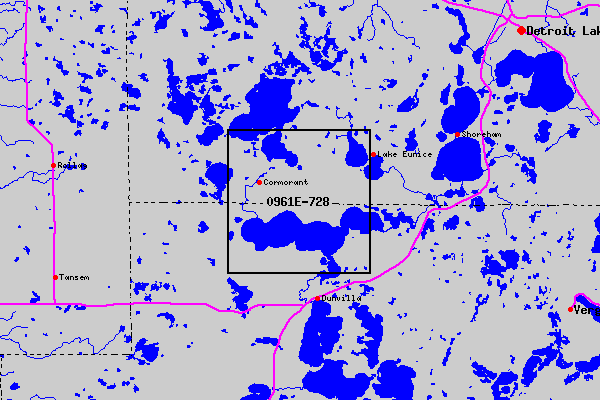
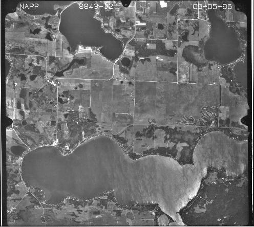
Aerial photographs archived and distributed by the USGS include the repository of multiagency National Aerial Photography Program (NAPP) photos at 1:40,000 scale in color infrared or black and white; National High Altitude Aerial Photography Program (NHAP) photos at 1:58,000 scale for color infrared and 1:80,000 for black and white; and aerial photos at various scales from USGS mapping projects and other Federal agencies such as the Bureau of Reclamation, Environmental Protection Agency, and the U.S. Army Corps of Engineers. Order Aerial Photographs On-line USGS maps may be ordered on-line from the USGS web site at http://edcwww.cr.usgs.gov/Webglis/glisbin/finder_main.pl?dataset_name=NAPP&method=place On-line Maps Locate Aerial Photographs Maps showing locations of each aerial photograph may be viewed on-line. An example shows Cormorant Township, Becker County, MN. NAPP photographs are about 9 inches by 9 inches square. An example shows the photo number 0961E-728 which covers the southeast corner of Cormorant Township, Becker County, the southwest corner of Lake Eunice Township, Becker County in the top half of the phtograph and Otter Tail County town of lower half. (NOTE: The full height of the photograph is not shown due to scanner limitations. Also, detail has lost since the file size has been reduced to decrease file loading time.)
Return to Becker County, MN main page |